Showing posts with label refuge. Show all posts

Monday, June 5, 2017

The Sands of Time


The scent of wild roses mixed with ocean air is heavenly.
 Since I arrived on the Olympic Peninsula, I have enjoyed some wonderful walks on natural lands. One of my favorites has been the Dungeness National Wildlife Refuge, also known as Dungeness Spit.

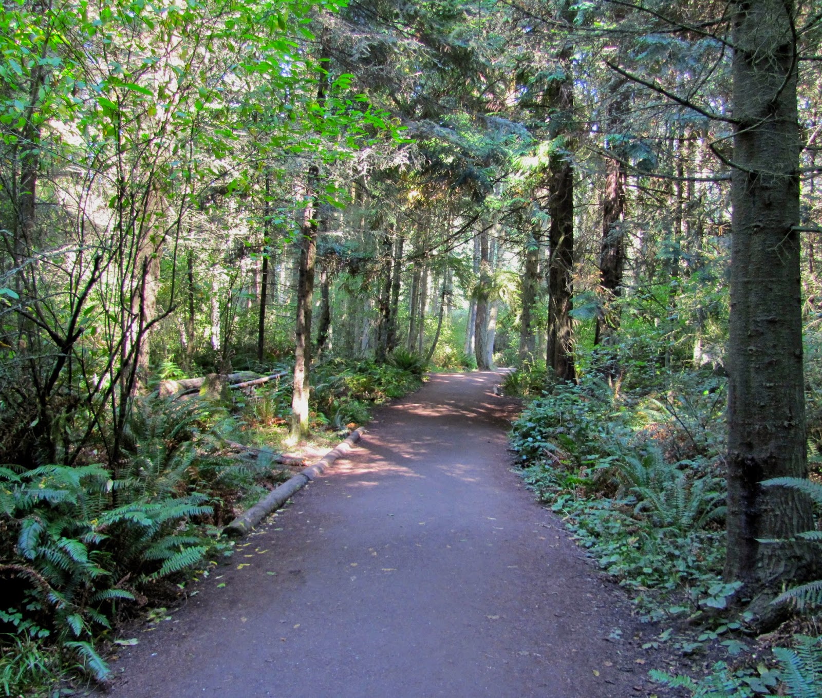
When I first came here in 2013, I was taken for a walk along the bluffs and was transfixed with the fragility and the beauty of a place that is in a state of constant change.

I walked these bluffs several times that year and often each year I come back at least a few times, sometimes to share it with visitors. Below are some pictures taken from 2013.

In 2013, there was still some walkway left near this post.
Now the post is gone, the tree is gone, the paths are gone.

This was in July 2013 and there was still a path to the right
of the photo. That path was eroded last year and is gone now.
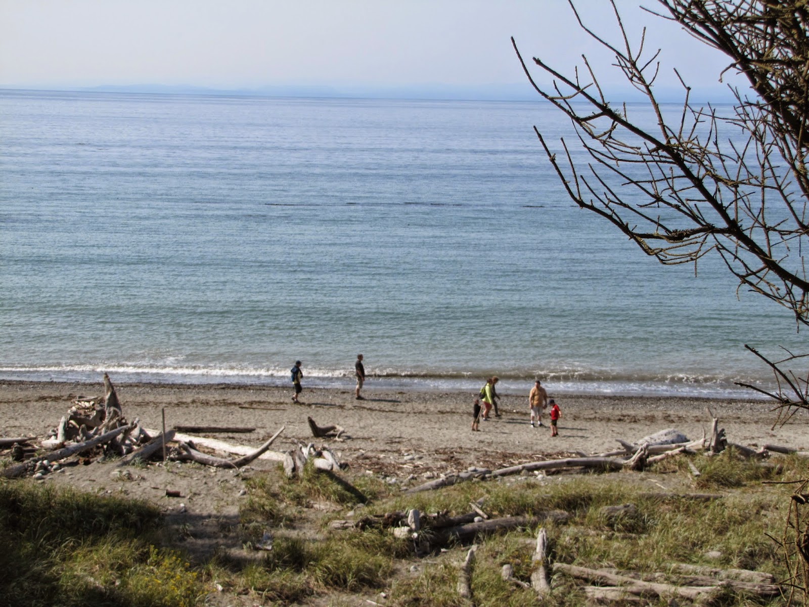
All of this bluff shown here is gone now. I'm estimating at
least 20 feet has been taken in the past four years.

This was a previous path; the Rangers have their work cut
out from underneath them...
Another view of the previous path... gone in 2017.


And today when I went for a walk to remember my friend Cynthia Little who has crossed over (one month ago today) as she was the first one to show me the bluffs with her dog, Keena, I was shocked to discover that in the last year alone, we have lost ALL the walkways!

And areas that were inland by 25 or 30 feet and were tree-covered are now open to the Sound with the encroachment threatening those walkways as well. Here are the photos from today.
The barrier prevents anyone from walking along the bluff;
that SW path was open last fall but I knew it was eroding fast.

A new sign, a new blockage preventing any foot traffic to
the east on the bluffs of Dungeness Spit.

Overstating the obvious; there's a 100-ft. drop there.

If you look closely, you can see a huge piece
of bluff is about to drop off.
While the view is still impressive, this view opened up this
last winter. Previously it was trees and undergrowth.
The light reflects off the Sound and this path may only be
here for another summer. This used to be thick with trees
and undergrowth. Ever-changing beauty.
Another view of the wild rose.
(I've done two other blogs on this area: "Hot Night on the Spit" and "The Dungeness Spit" if you want to read more about it and see some other photos.)
We have had a lot of gale force winds this last fall and winter, and also stormy seas. Both of these elements are part of the erosion of the spit. No matter how much the Rangers try to arrest the action, it will continue. The sands of time... sliding away.

Monday, August 25, 2014

The Dungeness Spit

Dungeness Spit map at trailhead, Sequim, WA.
The locals (on the Olympic Peninsula) call it "the Spit," but the real name is Dungeness National Wildlife Refuge.  Established in 1915 by President Woodrow Wilson, it is 636 acres of a variety of tidelands, beach and upland forest, including one of the longest natural sand spits in the world.

Fortunately it is less than five miles from my home and is a grand spot for walks; long ones or short ones. Even on drizzly days, it is a delightful escape from the moderate traffic of the area.
Upland forest trail heading toward "the Spit."

Today the weather was perfect for a rather long trek, but I didn't tromp all the way out to the lighthouse. That is a 10-mile round trip and I don't think I've trained enough yet.

The walk starts in the forest, and pleasantly meanders gradually downhill until that last 1/8th mile when it is somewhat steep, but on a wide, smooth trail.

Then the trail opens up and suddenly you can see the upper end of Puget Sound, the Strait of Juan de Fuca and across to the island of Vancouver, B.C.
The waves from the Strait of Juan de Fuca create the Spit,
and the bluffs nearby are gradually eroded.
On this gorgeous day, there were plenty of people sunning themselves and even a few were swimming in the water. One woman was walking the beach water line looking for stones in the shape of a heart. She said she collects them. This, in spite of the admonition on one of the signs that the taking of wood, stones or other items from the area is forbidden.
People do a lot of rearranging of the stones on the beach.

Judging from the number of stones in varying stages of being grinded away by the salt water action, I cannot think that there is a great risk of them disappearing because folks are collecting them.

Do you suppose there is someone who has catalogued them and is keeping track of where they all are? A fine government job!
Well, it looked like a heart for a bit...
it's the white one.

When I visited the Pacific coast, up at  Rialto  Beach, I noticed the stones there are being shaped much rounder. Here they are being washed flatter. Even so, I found myself walking and looking down and here is what I found:

A ship loaded with freight heads out to the Pacific Ocean.
Naturally I left it there. I imagined getting back to the Ranger kiosk and having them force me to empty my pockets and then suddenly a large crowd would gather and I would be further humiliated by getting caught... wondering now what the Federal Register lays out as the punishment for removing rocks. No wonder the indigenous peoples are in wonderment about all our rules.

All kinds of creatures, feathered, finny and furry, take advantage of this refuge.

During the spring the seals use the protected harbor beach at the end of the Spit for their pups. In the fall and the spring, the migrating birds take a break from their journey and other native birds are here all year.

This is the sea grass that is essential for nesting birds.
I didn't see one bird on the ground anywhere today. Perhaps they took a holiday. Of course there were seagulls.
The hotter-than-average summer has made the waters in the
Strait less than frigid. 
On my way back up the path I found myself passing a couple who were dragging their feet. Noting they were considerably younger than me, I asked them if they'd had a nice day, curious to learn why they seemed so tired. "We've just completed the walk out to the lighthouse and back," the guy told me. "It seemed shorter heading out than it was coming back," his female companion added.

The Olympic range is off in the distance. The eroding bluff
is to the left in the photo.

I feel so fortunate that I live in such a beautiful area. And that this portion of accessible loveliness is pretty close to my home.

When my son was out visiting we walked along the bluffs. There has been so much erosion, portions of the path I walked a year ago have disappeared and the Rangers have re-routed it.

I have no idea at what speed it will progress, or what will happen to the park itself if the bluffs simply disappear. At least the scientists can't blame the erosion on global warming. Or can they?
Waves on the shore; small now, but come back when the
fall winds whip them up and see them then.