Showing posts with label Puget Sound. Show all posts

Monday, June 5, 2017

The Sands of Time


The scent of wild roses mixed with ocean air is heavenly.
 Since I arrived on the Olympic Peninsula, I have enjoyed some wonderful walks on natural lands. One of my favorites has been the Dungeness National Wildlife Refuge, also known as Dungeness Spit.

When I first came here in 2013, I was taken for a walk along the bluffs and was transfixed with the fragility and the beauty of a place that is in a state of constant change.

I walked these bluffs several times that year and often each year I come back at least a few times, sometimes to share it with visitors. Below are some pictures taken from 2013.

In 2013, there was still some walkway left near this post.
Now the post is gone, the tree is gone, the paths are gone.

This was in July 2013 and there was still a path to the right
of the photo. That path was eroded last year and is gone now.
All of this bluff shown here is gone now. I'm estimating at
least 20 feet has been taken in the past four years.

This was a previous path; the Rangers have their work cut
out from underneath them...
Another view of the previous path... gone in 2017.


And today when I went for a walk to remember my friend Cynthia Little who has crossed over (one month ago today) as she was the first one to show me the bluffs with her dog, Keena, I was shocked to discover that in the last year alone, we have lost ALL the walkways!

And areas that were inland by 25 or 30 feet and were tree-covered are now open to the Sound with the encroachment threatening those walkways as well. Here are the photos from today.
The barrier prevents anyone from walking along the bluff;
that SW path was open last fall but I knew it was eroding fast.

A new sign, a new blockage preventing any foot traffic to
the east on the bluffs of Dungeness Spit.

Overstating the obvious; there's a 100-ft. drop there.

If you look closely, you can see a huge piece
of bluff is about to drop off.
While the view is still impressive, this view opened up this
last winter. Previously it was trees and undergrowth.
The light reflects off the Sound and this path may only be
here for another summer. This used to be thick with trees
and undergrowth. Ever-changing beauty.
Another view of the wild rose.
(I've done two other blogs on this area: "Hot Night on the Spit" and "The Dungeness Spit" if you want to read more about it and see some other photos.)
We have had a lot of gale force winds this last fall and winter, and also stormy seas. Both of these elements are part of the erosion of the spit. No matter how much the Rangers try to arrest the action, it will continue. The sands of time... sliding away.

Friday, August 26, 2016

Hot Night on the Spit

It was really hot in Sequim tonight, so I decided to go down to Dungeness Spit and have a picnic dinner.
Path to Dungeness Spit as sun sets.
I tried to find a friend to go with me, but one was going up to the lake and another was going to the casino to dance and the other one never replied.

Oh, well, I'm pretty good company for myself, so off I went. It was definitely in my plan to have a walk before or after dinner and this way I certainly got to do that... both ways.

There wasn't much of a breeze, and because it was already after 6 p.m., the path to the spit was quiet.

My picnic dinner on the spit.
I could hear birds fluttering about getting into a nest someplace, or making those last calls to others to come and roost. The sea air filtered up through the tall evergreens mixing with the dusty forest smell.

Nice. Peaceful.
I walked alone and just as I got down near the spit I could see a few folks making their way up the path because there is a deadline that everyone has to be off the beach one half hour before sunset. 

And out of the ether come yellow jackets. How do they know there is food to be eaten? I kept pushing one away and finally had to cover up what I was trying to eat, only opening it when I was ready to take a bite. And one of them got into the plastic bag that was holding grapes. But when I stopped feeling resistance to their presence, they took off. That was weird. 

When the tide is in, the spit looks like it is littered with
dinosaur bones. If you look closely you can see someone
up on one of the huge logs near the tideline.
Sunset watching is done up on the bluff and then you have to be out of the park at 'dusk,' which is a sort of fluid time because some days (if cloudy) it gets darker quicker than if it is clear, like it was tonight.
The Olympic range gets a lovely purple color as the light fades, but the
smoky haze affects the colors right now.
These are the bluffs that are eroding
at an alarming rate.
I did manage to walk for 43 minutes, getting credit for 4256 steps, which is about 2 miles, I think.

There is such a 'beachy' smell there... washed up bird feathers, small crabs, shells of other things, seaweed, damp sand from the recent high tide, and weathered salt-infused wood.
I later discovered this was a couple who were
celebrating a wedding anniversary.
Soon it was time to head back up and a couple that I had taken a photo of walking on the beach asked me to take their photo with their camera because it is their wedding anniversary. Congratulations, you two!!
The sun is setting earlier now; it was 8:05 p.m. tonight.


Then it was off to the bluff to watch the sunset. I am not sure if the time of sunset is when it starts or when it finishes. I wasn't watching my time as I took the photos. All I know is that it is now getting darker a little bit sooner every day.


No disappointment in the sunset tonight... all the smoke from the fires in the Olympics created a lovely reddish glow and I met a nice woman from Tacoma so we chatted as the sun set, with me taking photos as we shared observations. 
Just after the sun set, the Puget Sound breeze began and the
air chilled down immediately. And I live here!!
Thanks, Christina, for making the evening more colorful! And for using my favorite saying, "Does it get any better than this?"
Everyone is gone; hope the sun comes back tomorrow...
By the time I got home the temperature inside was down to a livable 75. I checked on the cats and they were still alive - not roasted yet.

Sunday, July 31, 2016

Miller State Park in Washington

Walking down the trail at Miller Peninsula State Park.
Miller Peninsula State Park is considered one of Sequim's attractions in Clallam County and today, July 30, the Olympic Peninsula Explorers (Volkswalkers) had their sanctioned walk.

Last week there was just a genial exchange between the Canadians and US walkers, and I walked almost eight miles. Today it felt longer, but it was really shorter; less than six miles overall.

Fungi amongi... not the latin name.
There is a wide diversity of plant life, including multiple types of fungi, tall evergreens and some pretty large deciduous trees as well. It was fun to stand quietly once in awhile and just listen to the needles, driven by the wind, raining down on the forest floor.

While there are several trails, the best (and shortest) one down to the water of Puget Sound takes about an hour down and back. Well, maybe for fast walkers it is less time, but we weren't rushing and for less nimble feet the trail shrinks for the last half-mile to a single file dirt path with roots, stumps, holes and rocks so it's sensible to pay attention and not get tangled up.

Still, the reward of seeing Protection Island from one of the closest locations from land was worth it.

We were lucky to have a 70-plus degree day with a light breeze instead of the one that preceded it yesterday (June 29) which was topping the 80 degree mark. The sun was shining hotly by noon, so this is good hike to make in the early part of the day. Even though the path has shady spots along it, the sun can be felt enough that sunscreen is also useful.

I like it when the trail bosses leave these trees where they fell.
The hike description said bug spray was needed, but we were fortunate to not have any issues. We did  meet one hiker who had gotten stung by a bee, so if anyone walking in  your group is allergic, be sure to have an epi-pen or a fresh copper penny* on hand. There is no way to easily remove someone from the park in an emergency like that.

This is the blue sea and sky at the end. It is
hard to differentiate which is which.
This is a better view of the Puget Sound as we arrived.
Except for the narrow trail down to the water for the last bit of the trip, there is plenty of space to walk side by side for easy conversation. This is a good walk for kids as there is plenty of running room before the trail.

Once down at the water it is easy to see eagles fishing and flying up into the wind vortices, and possibly puffins from Protection Island could be seen with some good binoculars. It was reported by a local TV station that humpback whales were seen near Discovery Bay this weekend, but I didn't see anything that dramatic in the water.
Protection Island sits almost at the mouth of Discovery Bay. This view is
one of the best to be had from land. A longer telescopic lens might help.
A rugged rocky shore looking sort of southeast, I think, toward Discovery Bay.
I had plenty to think about as I meandered down the trail and back again, lucky I had brought my two walking poles which I was able to share with another in our group.
This eagle flew right toward me from the water and then
landed on a branch only a few feet away... I was thrilled!
And so, after a really pleasant lunch/supper/tea with a new friend, I was ready to put my feet up and see how Foyle is getting on with his various detective challenges.
* I make no claims to the efficacy of a copper penny on a bee sting, but the hiker who was stung was using it for her relief.

Saturday, December 26, 2015

Hurricane Ridge Trip

Standing on the porch at the lodge at Hurricane Ridge in the
Olympic National Park, Port Angeles, WA.
I think I smell snow in that leaden sky.
   The last trip to Hurricane Ridge was on Beloved's Harley under sunny skies and of course the road up there was dry and clear.

Mt.Olympus is off to the right, past the snow-made polar bear.
   Today it was snow-covered and, in at least two places, had tree debris from trees dislodged with by snow or wind.
 
   And this time it required chains on tires, so I wasn't about to put myself through that experience again. (I think the last time was from my house in East Fork heading toward Ketchum in Idaho.)
Looking eastward, sort of toward Seattle, WA.
 
   So I rode up with a shuttle service and a trip that should have taken about an hour was almost twice that with a faulty chain install on a rear tire that went "whap-whap-whap" for 18 miles up and 18 miles back.

    It was impressive at the top, though.
   Over a week of steady snow and wind with periodic mild warmings had created some very long icicles and snow statues from trees that were totally covered.

   I stepped off a path for cross-country skiers and sunk down to my waist... and the snow was really blue even a short distance down.
I love this color blue under these circumstances. I think it
might be less appealing if it was much deeper and I was in it.
   The most fun was enjoying the smell of snow, the crunch under my feet, and my body was remembering the guarded expectation of putting on skis, heading off for a powdery run, the wonderful exhilaration of feeling the weight shift back and forth while whooshing downhill.

The lodge to the left has an overlook spot below,
but it is covered in snow up to about six feet.
   When my kids try to encourage me to take up skiing again I explain that it's not a sport for seniors who have stopped it for a decade, and besides, it's significantly more expensive to rent all that gear now that it was 10 years ago... and just for a one-weekend experience?

   I have skied in N.H., Vermont (Suicide Six, especially), Massachusetts, Idaho, Calif., Canada and Austria. I have skied with some of the most interesting folks when I worked at Sun Valley and that includes volunteering with the Ski Patrol.

   Getting older should mean getting wiser, too.

   And so when I had my last downhill ski trip with the Scottsdale Sail and Ski Club, I decided it was time to enjoy it to the fullest and then sell my equipment.

   The two close calls I had with other skiers who were skiing out of control only confirmed it was time I did just that.

"Sandy Banks" in a snow bank...
Halfway down the ridge, after the tunnels, looking down on
Sequim, WA and Puget Sound.
   I can still cross-country ski or snowshoe, and perhaps I will do more of that this winter.

Unknown couple heading off on the Cross Country trail.

There is still a lot I can do to enjoy the times I go out into wintry weather, and I hope, dear readers, you have enjoyed this trip into a wintry wonder just a short distance from Sequim.

Tuesday, May 12, 2015

My Solution

Royal Shell Oil's rig, parked in Port Angeles, WA harbor.
There is a huge, 300-ft. tall, bright yellow oil rig parked almost at my front door. It's not really 'my front door,' but it is the door to the Olympic National Forest. And you can't miss this thing as you drive into town.

So, I started thinking of it in a more positive light.

And I wrote a letter to the Peninsula Daily News about it.

"I recently learned that the huge oil drilling rig that is parked in full view of anyone driving near Port Angeles Harbor is here to stay for a while (“Giant Oil Rig Probably Will Stick Around,” PDN, May 5).

This depressed economic climate clamors for some creative solutions, and that ugly rig just demands a colorful makeover.

How about we see if Shell will moderate its rigid stance of using it just for oil drilling and allow us to have it as a water slide for the summer?

And when the next rig arrives, perhaps we could set them up close enough to run zip-lines between the two of them so folks could have some more fun?

Even having tours of the oil rig would offer a tourist attraction.

When is the last time you were on one? Or even curious about what they are like?

Water taxis would make money taking folks out to the slide and zip-line or tours, concession people could set up hotdog stands and liquid refreshments nearby, and tourists would flock here from British Columbia and points eastward for a never-to-be-experienced-again, once-in-a-lifetime, oil-rig summer fun trip.

Hotels would have no-vacancy signs out because lots of other fun things would come from the energy of having a purpose in our harbor at long last.

Anyone with other ideas is welcome to submit them [to letters@peninsuladailynews.com. Or register a comment in the Reader Comments, below.]

I'm not wedded to these but wanted to get people thinking instead of complaining.

Sandy Banks,
Sequim"

And, you know, there were some interesting replies and a few 'got' what I was suggesting... that you can take this huge yellow thing and make lemonade out of it.

I kinda wish Shell Oil would take my ideas to heart... and at least let us have some tours... my old Public Relations brain started working and I began thinking about all the positive ways they could turn around public opinion, including by starting with little kids getting on board with drilling.

Not that I really would want that, but my experience has shown me that when you want to shift public opinion for good, you start young.

Well, that's all the news that fits tonight.

Saturday, June 8, 2013

I'm a 'drive-by shooter'...

There wasn't much else to do; there was little opportunity to stop and shoot, and in some places it wasn't allowed at all. So this is the story and the reason why I am being called a 'drive-by shooter.'
Along the coastline of the Juan de Fuca Strait, northern
Washington State, heading toward Neah Bay in Clallum
County, the Makah tribal lands.
Last Thursday, at 9 a.m. a bus was loaded up with more than a dozen seniors from the Sequim Senior Center and we headed west (although it felt like north) for the Neah Bay and Makah (pronounced Mah-ki-ee) indian tribal grounds. I am usually pretty well informed when I head off on any trip, but this was a short notice event and I was sadly ignorant about a lot of the history of Neah Bay, located at the northwestern-most point of the U.S. in the State of Washington. It is about two hours driving time from Sequim, not including any stops, of which there was only one - in Joyce, at the General Store. (The link to Wikipedia will answer more of your questions, if you care to formulate any.)

Makah Senior Center in Neah Bay, Washington.
After our stop in Joyce, we drove up and over a portion of the Olympics to reach the Makah indian nation (This link to Wikipedia explains much about the tribe.). There is a lot of logging going on, as truck after truck went by loaded with timber. The road is windy with many curves designating 25 mph and indications of clear-cutting having occurred in the past. But there were also a significant number of old-growth trees still standing.

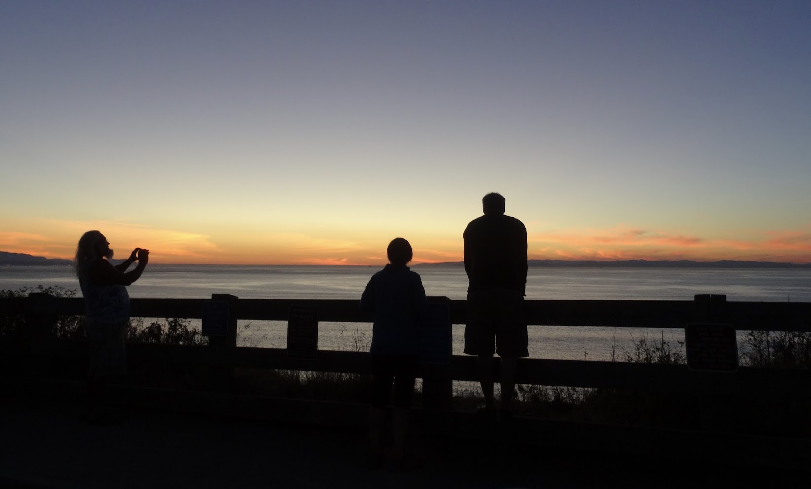
Periodically the road would parallel the body of water called Strait of Juan de Fuca, the main waterway route for ships coming into Seattle from their Pacific journey and an area of water that is loaded with fish of all kinds, including halibut.

Neah Bay from Senior Center looking toward marina.

Neah Bay from Senior Center looking toward Vancouver
Island, B.C. over Straits of Juan de Fuca. 
Outside the Makah Senior Center.

We arrived at the Makah Senior Center for the lunch we were promised, and it was a wonderful meal with a surprise gift of a tote bag, hand-made tea bag holders, a flashlight, and a hand-crafted necklace made by local seniors and members of the Makah tribe.

The meal was a delicious beef stew accompanied by a macaroni shell and shrimp salad, a green salad, bread and butter and two desserts - a fruit salad with coconut and a portion of pie.

No one left hungry, that was for sure! The views from the deck of the senior center were delightful and I am sure when it is a little bit warmer that this is a nice place to enjoy some sunshine and gentle breezes.

The welcome of the tribal members was very special and warm and was an added element of delight for the trip overall. We were bussed over to the Makah Museum where June, a tribal elder, gave a detailed tour of the artifacts. Our introduction was to learn that the name of the tribe means, "People who live by the rocks and seagulls." She explained the history of the tribal lands and how the Makah peoples lived. We were not allowed to take any photos or do any sketching, and although we were not told why, my past experience with native peoples is that it is because we are looking at 'remains' of their way of life, and while historically important, they are also part of the ancestral burial sites, even though - in this case - it was due in large part to a mudslide, not a planned location.

Ozette Lake is one of the largest natural and undeveloped lakes in the State of Washington, and is now a popular place for hiking and camping during the summer. But it was once the central home of the Makah tribe, a good place to have a home with access to the Pacific waters for whaling and fresh water for the tribal needs. The archeological information places the origins of the people back over 4,000 years, making it one of the oldest native groups in North America. The Makah used to be a whaling community, but with the devastating mudslide which destroyed the ancient village in Ozette about 1750 and the consequences of smallpox from the Europeans later on on another nearby village, the remaining portions of the tribe seemed to have relocated closer to Neah Bay. The archeological dig is on the National Register of Historic Places, but is privately owned by the Makah nation.

Shells collected on the beach have been strung together
with beads and a carved whale tail for this necklace.
In the museum we were invited to sit in a replica of a longhouse, the native american version of an apartment house where several families lived together, except that the families worked together to keep everything working which is where the concept diverges. There we heard about how the tribe was structured, without chiefs, but group leaders who helped their people survive. And how today the Makah are working together to keep their young people healthy and fit.

We were shown the beautifully crafted whaling boats, made from one large tree, and all the implements needed for bringing in the large marine creatures. One interesting fact is that there were several Makah 'warriors' who were trained to hold their breath long enough that they could swim to the mouth of the whale and sew it shut after it had been harpooned, so then it could not dive. This was fascinating to me; that these ancient peoples knew how to keep a whale afloat. And once it was secured, they would tow it back to the shore to harvest, using all of the creature for their livelihood - blubber, meat, bones.
This necklace of shells and beads honors the seal-hunting
traditions of the Makah people.

Another interesting fact was that the wife of the man who would do the harpooning was required to go to bed, not eat and be quiet while her husband was off looking for, and getting, the whale. It was believed that if she was peaceful, her husband would not have to deal with a thrashing and dangerous whale and he would come home with a successful hunt's reward, a large and bountiful whale. The other women in the tribe would care for her, wash her, attend the children, and generally support her for the two or three days of the hunt. In this I can really see the concept of "it takes a village..." at work.

The Makah Cultural and Research Center Museum is well worth a visit.
It will take at least two hours to complete the tour and shop at the store.
In late August each year Neah Bay celebrates Makah Days, honoring the day years ago when the tribe accepted the flag of the United States to fly over their territorial lands. But it is sad to realize that the Treaty of 1855 took much of the land the tribe used, limiting their use to about one third of the original area claimed by the Makah. However, the elders were astute enough to keep in their rights to hunt whales and in May, 1999, knowing the whale population had improved, they asserted those rights and did go and bring back one grey whale, the bones of which are displayed in the museum.

The Makah people are instrumental in coordinating the annual 'journey' of native peoples by canoe and boat, a celebration of the old ways of living. This year the journey is in July, but the actual date was not discussed. Here is a link for the calendar of events of native peoples on the Olympic Peninsula. It should be a photographer's dream with all the colorful regalia (native dress and ornamentation) and events... I hope to be able to go and report on it, but I also have Colombia calling me, so we shall see what evolves.

At least no one was hurt in this drive-by shooting... and you can see more pictures here.