Showing posts with label wildlife. Show all posts

Wednesday, October 25, 2017

A Volcano and Memories

Mount St. Helens in Washington State on Oct. 24, 2017 from viewpoint.
On the 24th of October (a lovely and warm, sunny, Wednesday), my traveling companion, Wayne, and I drove up to the Mount St. Helens National Volcanic Monument. Established in 1982, after the explosive eruption on May 18, 1980, the 110,300 acre site provides an opportunity for exploration, research, education and recreation.

Remaining trees from the blow-down after the eruption.
Little trees and other plants continue to
take hold and gradually change the
landscape of the starkness of 35 years.
I recalled that day as we were driving up toward the viewpoints. I was living in Boise, ID, with two daughters who were 9 and 11.  I wouldn't meet up with my son's father until July or August of that year. And my son would arrive the following year. (Here is a link to Wikipedia's information page: Mount_St._Helens) And shortly after the eruption, the ash from the volcano began to fall in Boise. It was only a couple of weeks later that we ended up adopting a grey cat we called "Cinder."

Wayne looks out for elk and deer in the foothills.
I don't recall all the details of that particular day, but we began seeing ash fall in the afternoon. The girls were intrigued, but I was worried. What did it mean? How much would fall? And I vaguely remember news reports being broadcast of the actual eruption which was fascinating. It was exciting and scary at the same time.


A Noble Fir grows along a path that is
at the Loowit Viewpoint allowing folks
to walk a trail along the fallen trees.

Wayne walks further out on the Loowit Viewpoint trail.

The Toutle River cuts through the mud and ash.

Color returns to the landscape.

Wayne walks the Loowit viewpoint trail.
Movie viewing room has a magnificent view of the volcano.
Johnston Ridge Observatory; named after David A. Johnston,
a volcanologist who died moments after the eruption started.
He was standing on nearby Coldwater ridge.
The center lava dome that built up after the eruption. Taken
using my telephoto lens on a Canon EOS Rebel.
Right side of the crater. 
Inside the lower left side of the northern ridge (blown out)
and the newest lava dome is to the right. No significant
volcanic activity has occurred since 2008.

Seeing this huge mountain from a closer view brought all those images back and up at the Johnston Ridge Observatory the pictures were there once again. It was as if history was doing a forward and back in my head all day.

Wayne, as a former Department of Natural Resources employee, was a great source of information about all the Noble Firs that were seeded the following couple of years into the ash fall and other aspects of re-foresting a huge area that was blasted by the explosive event.

It was amazing to see these 34-year old trees and other landscape changes giving new life to everything in the area. And it was impressive to be able to look up at the open side of the mountain and see the new growth inside it as well.

Later we took a walk around the new Coldwater Lake, formed after the eruption, and came upon two bucks who were as surprised to see us as we were to see them. New life and new directions are part of living in general and I took this day as an affirmation of that occurring for me now.

Monday, June 5, 2017

The Sands of Time


The scent of wild roses mixed with ocean air is heavenly.
 Since I arrived on the Olympic Peninsula, I have enjoyed some wonderful walks on natural lands. One of my favorites has been the Dungeness National Wildlife Refuge, also known as Dungeness Spit.

When I first came here in 2013, I was taken for a walk along the bluffs and was transfixed with the fragility and the beauty of a place that is in a state of constant change.

I walked these bluffs several times that year and often each year I come back at least a few times, sometimes to share it with visitors. Below are some pictures taken from 2013.

In 2013, there was still some walkway left near this post.
Now the post is gone, the tree is gone, the paths are gone.

This was in July 2013 and there was still a path to the right
of the photo. That path was eroded last year and is gone now.
All of this bluff shown here is gone now. I'm estimating at
least 20 feet has been taken in the past four years.

This was a previous path; the Rangers have their work cut
out from underneath them...
Another view of the previous path... gone in 2017.


And today when I went for a walk to remember my friend Cynthia Little who has crossed over (one month ago today) as she was the first one to show me the bluffs with her dog, Keena, I was shocked to discover that in the last year alone, we have lost ALL the walkways!

And areas that were inland by 25 or 30 feet and were tree-covered are now open to the Sound with the encroachment threatening those walkways as well. Here are the photos from today.
The barrier prevents anyone from walking along the bluff;
that SW path was open last fall but I knew it was eroding fast.

A new sign, a new blockage preventing any foot traffic to
the east on the bluffs of Dungeness Spit.

Overstating the obvious; there's a 100-ft. drop there.

If you look closely, you can see a huge piece
of bluff is about to drop off.
While the view is still impressive, this view opened up this
last winter. Previously it was trees and undergrowth.
The light reflects off the Sound and this path may only be
here for another summer. This used to be thick with trees
and undergrowth. Ever-changing beauty.
Another view of the wild rose.
(I've done two other blogs on this area: "Hot Night on the Spit" and "The Dungeness Spit" if you want to read more about it and see some other photos.)
We have had a lot of gale force winds this last fall and winter, and also stormy seas. Both of these elements are part of the erosion of the spit. No matter how much the Rangers try to arrest the action, it will continue. The sands of time... sliding away.

Monday, August 25, 2014

The Dungeness Spit

Dungeness Spit map at trailhead, Sequim, WA.
The locals (on the Olympic Peninsula) call it "the Spit," but the real name is Dungeness National Wildlife Refuge.  Established in 1915 by President Woodrow Wilson, it is 636 acres of a variety of tidelands, beach and upland forest, including one of the longest natural sand spits in the world.

Fortunately it is less than five miles from my home and is a grand spot for walks; long ones or short ones. Even on drizzly days, it is a delightful escape from the moderate traffic of the area.
Upland forest trail heading toward "the Spit."

Today the weather was perfect for a rather long trek, but I didn't tromp all the way out to the lighthouse. That is a 10-mile round trip and I don't think I've trained enough yet.

The walk starts in the forest, and pleasantly meanders gradually downhill until that last 1/8th mile when it is somewhat steep, but on a wide, smooth trail.

Then the trail opens up and suddenly you can see the upper end of Puget Sound, the Strait of Juan de Fuca and across to the island of Vancouver, B.C.
The waves from the Strait of Juan de Fuca create the Spit,
and the bluffs nearby are gradually eroded.
On this gorgeous day, there were plenty of people sunning themselves and even a few were swimming in the water. One woman was walking the beach water line looking for stones in the shape of a heart. She said she collects them. This, in spite of the admonition on one of the signs that the taking of wood, stones or other items from the area is forbidden.
People do a lot of rearranging of the stones on the beach.

Judging from the number of stones in varying stages of being grinded away by the salt water action, I cannot think that there is a great risk of them disappearing because folks are collecting them.

Do you suppose there is someone who has catalogued them and is keeping track of where they all are? A fine government job!
Well, it looked like a heart for a bit...
it's the white one.

When I visited the Pacific coast, up at  Rialto  Beach, I noticed the stones there are being shaped much rounder. Here they are being washed flatter. Even so, I found myself walking and looking down and here is what I found:

A ship loaded with freight heads out to the Pacific Ocean.
Naturally I left it there. I imagined getting back to the Ranger kiosk and having them force me to empty my pockets and then suddenly a large crowd would gather and I would be further humiliated by getting caught... wondering now what the Federal Register lays out as the punishment for removing rocks. No wonder the indigenous peoples are in wonderment about all our rules.

All kinds of creatures, feathered, finny and furry, take advantage of this refuge.

During the spring the seals use the protected harbor beach at the end of the Spit for their pups. In the fall and the spring, the migrating birds take a break from their journey and other native birds are here all year.

This is the sea grass that is essential for nesting birds.
I didn't see one bird on the ground anywhere today. Perhaps they took a holiday. Of course there were seagulls.
The hotter-than-average summer has made the waters in the
Strait less than frigid. 
On my way back up the path I found myself passing a couple who were dragging their feet. Noting they were considerably younger than me, I asked them if they'd had a nice day, curious to learn why they seemed so tired. "We've just completed the walk out to the lighthouse and back," the guy told me. "It seemed shorter heading out than it was coming back," his female companion added.

The Olympic range is off in the distance. The eroding bluff
is to the left in the photo.

I feel so fortunate that I live in such a beautiful area. And that this portion of accessible loveliness is pretty close to my home.

When my son was out visiting we walked along the bluffs. There has been so much erosion, portions of the path I walked a year ago have disappeared and the Rangers have re-routed it.

I have no idea at what speed it will progress, or what will happen to the park itself if the bluffs simply disappear. At least the scientists can't blame the erosion on global warming. Or can they?
Waves on the shore; small now, but come back when the
fall winds whip them up and see them then.

Tuesday, July 15, 2014

Lavender is in the air...

It's that time of year again on the Olympic Peninsula... the weekend of the Lavender Festival. (The link will tell you all about it.)

Lavender in bloom on the Olympic Peninsula a few weeks ago...
But it's been drier than usual, so some of the lavender growers have already started harvesting some of their crop because it doesn't do to have the flowers come to a fuller bloom too soon.

Still, there's plenty of the purple haze and smell to satisfy the tourists.

Last year I planted my own lavender bush and because I moved in January, the transfer of the bush did not go well. It needed to go into the ground earlier rather than later, but I think it will survive and maybe next year it will have the intensity of its neighbors.

Protection Island in Washington State, in the Strait of Juan
de Fuca, in the mouth of Discovery Bay, near Sequim.
This weekend, there's dinner cruise to Protection Island, a national wildlife refuge, to see the local marine birds. Some of the funds paid for the trip will support the local Audubon Society. I have been wanting to get out there since I moved to this area, so I'm hopeful this may be one of the nicest photo journeys I've been on in awhile.
Close up of the lavender flower, a wonderful scent, if you
aren't allergic to it, which I know some folks are.

The island is one of two of the local nesting places for the Tufted Puffin, and as one of my birder followers (Margaret in Italy) knows, these are interesting and an endangered species.

It's likely the weather is going to continue to be dry and warm, but I'm going to be prepared for the coolness that being on the water at dusk brings.

A good friend is moving to Albuquerque, New Mexico, in a couple of weeks. She was one of the first people who befriended me when I arrived in Sequim, and it will be hard to not have her living nearby.  I completely get the reasons for her move, and people move in and out of our lives all the time, in one way or another. But I don't have to like it, do I?


Sunday, June 29, 2014

The Enchanted Forest

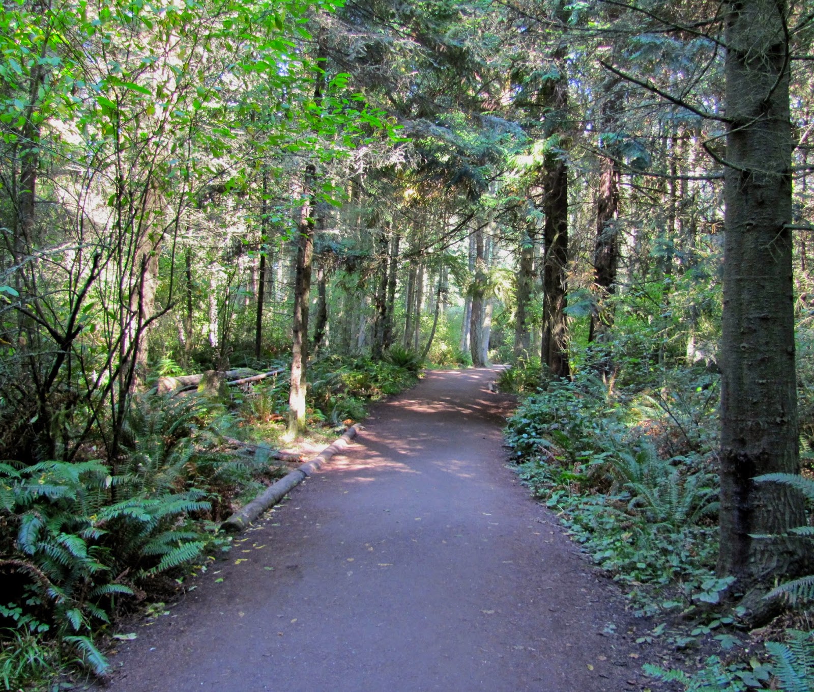
When I was growing up, there was a small forest behind our house on Pine Street. At one time, I don't have any idea how long ago it was, there was an active quarry in that section of woods as well.

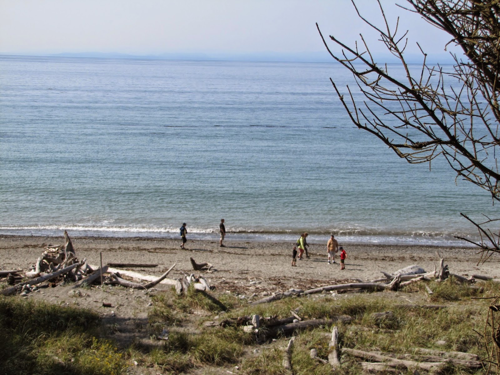
Aboard the ferry "Salish" to Whidbey Island, I caught this
nice pattern of shapes and color before we departed.
I used to go for walks there by myself when I was probably five or six years old. Those were the days when children were less at risk for getting lost just because they spent time exploring. And it probably was a contributing factor that my mother was an artist who didn't really want to spend time mothering, so the nanny she hired to care for my younger brother was preoccupied with him. (This is not "Oh, woe is me, poor abandoned child..." but a statement of fact.)

At any rate, I went to this piney woods often in the summertime. It was quiet, and there were some huge boulders that had gotten pushed into each other, creating a cozy little hide-away, filled with needles and leaves and cones from winds and previous seasons, in between them. (I know I didn't go there much after I was 10 or 11 because I was too big to fit in that space anymore.) It was my enchanted forest, where fairies and gnomes and my mystical life got nourished.
On this grey day, the canopy of trees took on a lovely
pattern only seen when one looks heavenward.

Once, when returning from the boulder site, I came up a path and was face-to-face with a doe and her two rump-spotted fawns and an 'auntie,' and I think a yearling. They stopped and looked at me, sniffing the air, and I was transfixed with the beauty of the group, standing breathless watching to see what was going to happen next.

It was one of those moments in time that seem to stop clocks... the world might have even stopped spinning as we faced each other. A crack of a twig somewhere broke the silence.  We all looked in the direction of the noise and there was the male, leader of the herd, fully antlered, coming to check on his girls.

There was no fear anywhere. We all sort of nodded at each other. The deer clan headed calmly off to the nearby field for grazing, perhaps to the place where I knew berries were nearly ready, and I sank to the ground, exhausted by the exhilaration of being so close to creatures I had read about.

72-acre Earth Sanctuary is located on Whidbey Island, off
Newman Road. It is $7 per person and $1 for the guide.

Fallen trees also serve as homes for the wildlife.

Yesterday I walked through a nature preserve, the Earth Sanctuary, on Whidbey Island that is privately owned and maintained. This forest fed me with the same etheric energy of my childhood. I returned home refreshed, cleansed and totally exhausted from it, sleeping two and half-hours, getting up for dinner and then falling into another wonderful and restful sleep until the six o'clock bird-fest outside my window woke me up.


This 72-acre Sanctuary is not unlike that of Willard Pond, another precious bit of protected land that our family gave over to New Hampshire Audubon to manage. I grew up appreciating the dangers of avarice for beautiful ponds and my grandmother Elsa dePierrefeu's wisdom created a 1700-acre wildlife preserve that still today offers the pavement-weary soul a place to retreat, repair and renew one's energy.

The wooded wetlands of this private land have over 80 species of native plants, including some delicious-looking red and yellow raspberries. (No, we did not take any. We did not see a sign that said we could not, but we felt we were on sacred ground and should leave the fruits of it to the residents; the deer, the birds, the beavers and muskrats and other critters that call this home.)

Raspberries are coming to fruit all over Washington now.
Ponds and bogs each have their role to play in nurturing a
healthy forest environment for all creatures, including slugs,
which are my least favorite creature overall.
I have never seen this fruit in the marketplace, but went to a
class recently to learn how to grow them at home.
There are printed, self-guided naturalist tour guides for free ($1 if you decide to keep one.) and posts with letters on them to help you determine what you are seeing, along with an explanation of why it is what it is.
The trail to the left leads to first Medicine Wheel area while
the trail to the right leads to the ponds and the Labyrinth and
Prayer Stone, more easily accessible.
The echoing basso-profundo music of these residents made
for a curious question by a tourist ... "What is making those
sounds?" I showed her how to find the source; she was entranced
and now, informed. Perhaps she also learned that they are
invaders and not particularly desirable, unless the Osprey
enjoy having them for dinner.
By taking the trail to the left, we found our way to the Cottonwood Stone Circle and the Tibetan Prayer Wheel. There is a spot for making an offering and burning tobacco. If it had been sunnier, we might have stayed long enough to see how the shadows played out on the ground.
Tibetan Prayer Wheel

Cottonwood Stone Circle


If you are planning to experience the Medicine Wheel section, be prepared to remove your shoes, carry some fresh tobacco for an offering, and either matches or a lighter to light it. At the time of our visit there was some tobacco and some sage for smudging, but the matches were wet. Also, no photographs are allowed of this sacred place, so please do not violate Native American customs by taking any.

Path is wide, but has a significant incline in
both directions. A bit challenging for wheeled
chairs or folks with walking issues.
In my opinion, the wetland trails on the farther part of the western end of the Sanctuary are not un- wheel-chair friendly, but a bit challenging, based on inclines in both directions for people with walking limitations. For example, my walking partner, due to knee issues, wasn't able to walk up the Celestial Trail at this time due to the steepness coming down.

There are plenty of places to sit and meditate in the area.
As it is not a public lands place, this is certainly not required to be ADA, but useful to know if you are traveling with someone who has such limitations. We were not able to explore the eastern end beyond visiting the Stupa very briefly due to time and weather, but another visit this fall is intended.

As we were returning to the parking lot, my totem, the American Robin, came and perched on some piled up prayer stones - a sign for me that I had come to the right place at the right time.

Visitors to the Stupa/Tibetan prayer location can use the
prayer wheels and the gong to enhance the experience.
All in all, it was a wonderful walking and meditating experience, shared with a special friend. There were a few other folks, but it wasn't at all crowded, and everyone respected the purpose of not talking while on the paths.

You can visit the Sanctuary on a day-trip basis or stay at the Retreat building on site. For more information, go to earthsanctuary.org.

If you don't have email or internet access, you can phone Celia at 360-321-5465.